We have been given a free copy of an Audio Tour of the Birdsville Track to review. We will do a full review on it soon but what we have heard so far is awesome, so stay tuned.
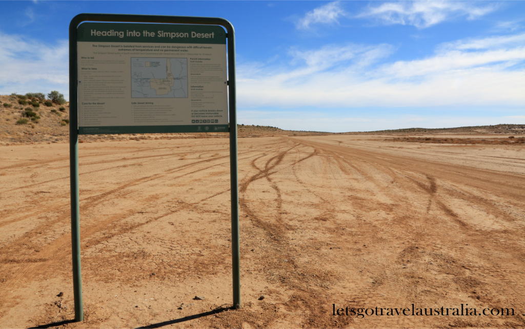
For some people, like us, crossing the Simpson Desert is on their bucket list. For others it may not even be a thought, for others you may like to, wish you could or the opportunity or practically may not be an option for you. We are not sure if we will have the opportunity to cross the Simmo again which is why we are crossing one way and coming back another route and allowing 2 weeks to do it.
We write this as a record for ourselves, track notes for others planning a trip but also for those who are not as fortunate as us in being able to tackle such an adventure. We hope you can experience your Simmo crossing through our journey.

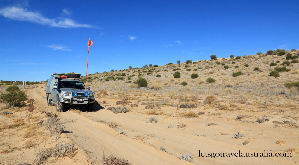
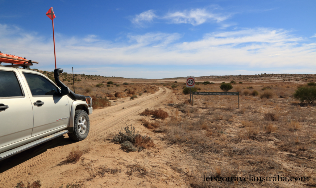
At the turnoff to the start of the Warburton Track are some signs, one stating that sand flags must be used, Chris stopped and put ours up.

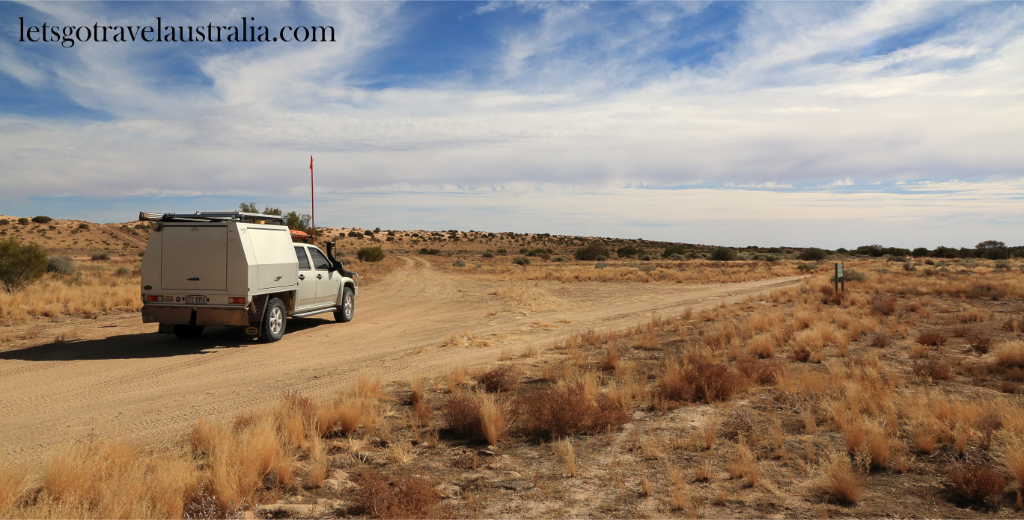
Driving on the first part of the Warburton Track was like driving on a bush access track. Driving through some low-lying areas of the flood plains. At the river is a sign saying no camping, water is for stock only but we knew many ignored this as there was a small caravan already setup. One assumes just come off the Birdsville Track in search of a quiet campsite. Five 4×4’s were just ahead of us and they seemed to disappear around this area as well, we assume up a side track near the river.
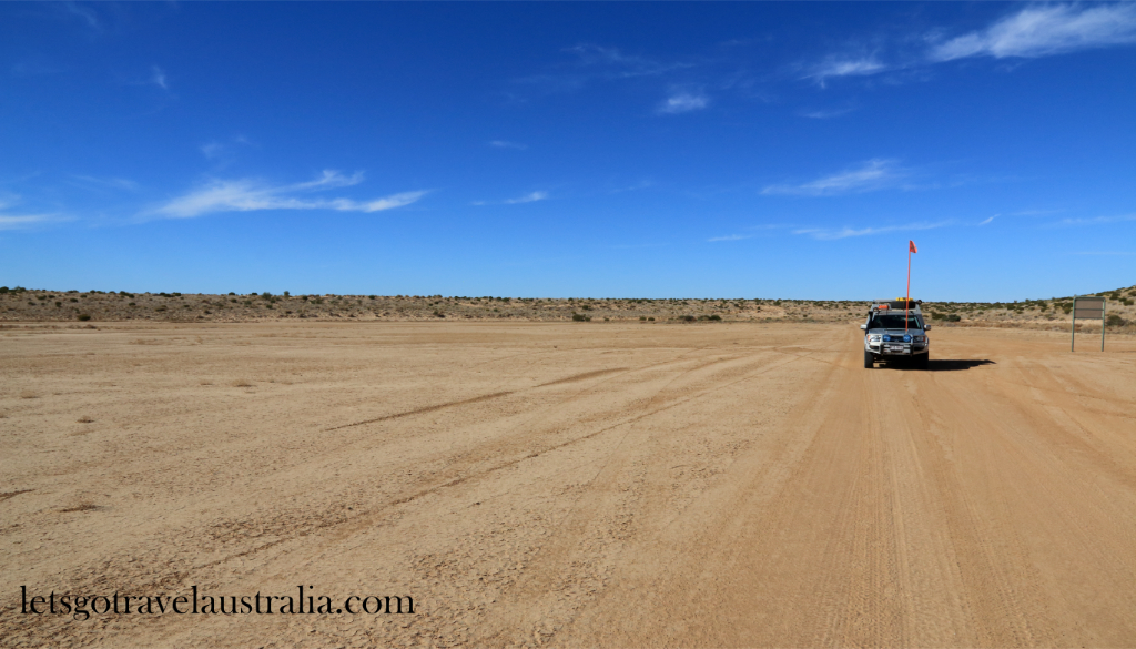
About 26kms up we came to a turnoff to the left that wasn’t signed posted. There was a track off to the right as well, we confirmed with the Hema Android map we were on the right track. From here the terrain changed slightly driving past many clay pans, the road became more corrugated and bumpy. Not a terrible exciting track.
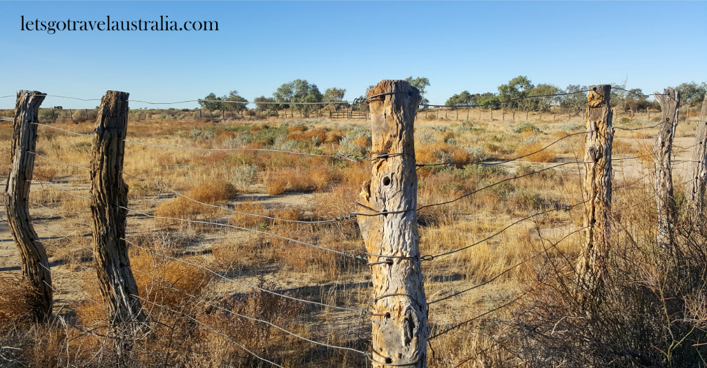
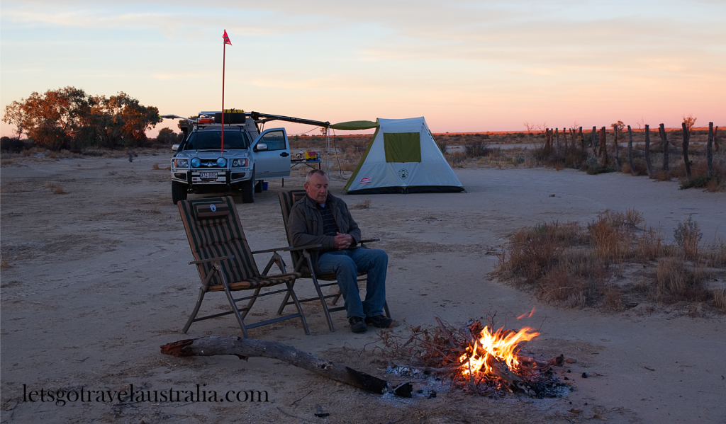
19km futher on was some old stock yards, with a large flat clay pan behind it. Many trees lined the dry creek bed behind it. This is where we decided to make camp for the night.

Just as we were setting the tent up a big gust of wind camp up and we had to hold tight onto the tent and peg the awning on the Ute down. Didn’t take us long to be set up, with our bed looking pretty cosy in the tent. There was plenty of small dry wood lying around so we collected some up for a fire.
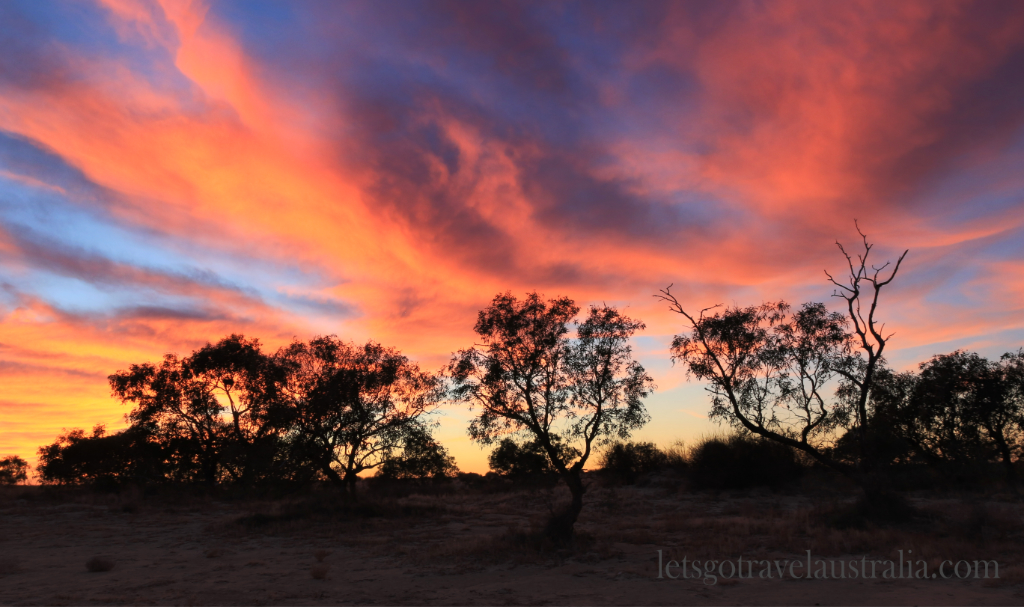
Cameras and tripods came out for the anticipated sunset. The sunset itself was a bit of a fizzy but the afterglow sometime later nearly caught us off guard as we raced back to our cameras.

It was a pleasant evening around the campfire looking up at the open clear skies and the millions of stars.
We were snug as a bug in the tent and were surprised when we zipped the door down in the morning how much warmer it was in the tent. We were greeted with the sky lit up with red and yellow hues, awesome.

Chris re started the fire which we sat around eating our breaky. Can you get a more awesome start to the day.
The group of five 4×4’s passed us as we were packing up, we weren’t in a hurry and had morning tea by the remains of the fire before heading off.
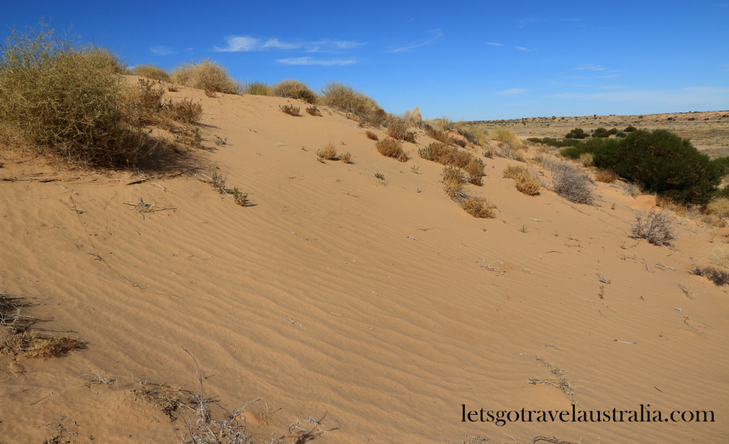
Starting to get into sandhill country now, the vegetation is sparser. Approx 16km from the yards we crossed into the National Park. The terrain changed again with lots of dead trees and flat clay pans in the swales of the Sandhills. The road changes many times, with corrugations, sand and ruts.
60km from the yards is the old Kuncherinna Oil well, there is an old sign that marks the spot but it is very hard to read. We climbed up and explored one of the sandhills.

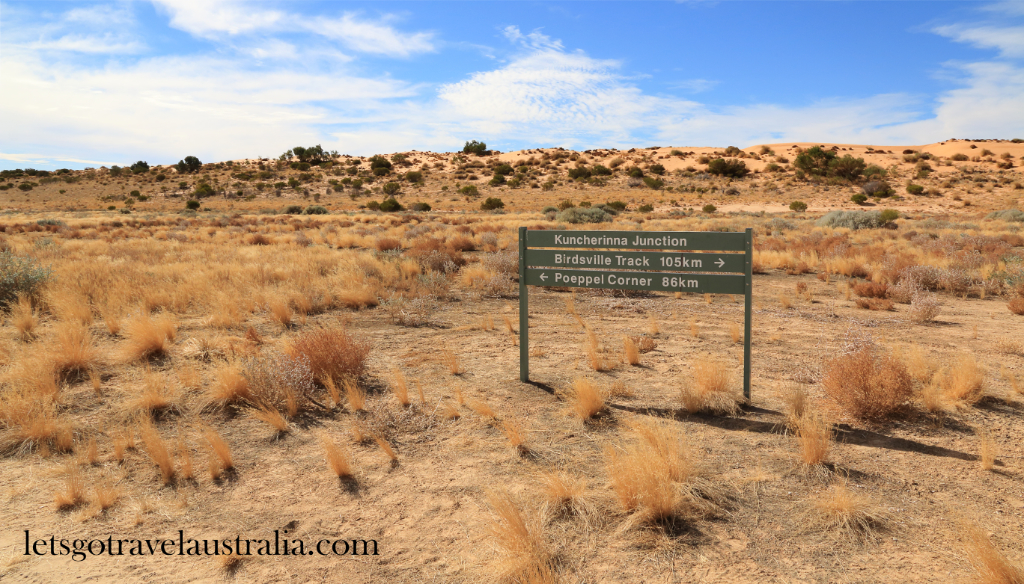
Just a few meters up from that is Kuncherinna Junction, which is the turn off to the Rig Road and K1 Line. GPS 26° 42’ 11” 138° 15’ 58”